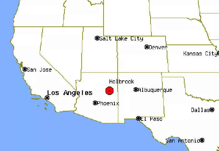
Holbrook is a small city in Navajo County, Arizona, known for its rich history and unique landscapes. Located along the iconic Route 66, it serves as a gateway to the Petrified Forest National Park. If you’re looking for Holbrook on a USA map, you’ll find it in the northeastern part of Arizona, near the border with New Mexico.
Geographical Location of Holbrook
Holbrook sits at the following coordinates:
- Latitude: 34.9086° N
- Longitude: 110.1589° W
It is positioned in the high desert region of the Colorado Plateau, offering stunning views of red rock formations and wide-open skies. The city is easily accessible via Interstate 40, which replaced the historic Route 66.
Historical Significance of Holbrook
Holbrook has a deep connection to the Old West and the railroad era. Key historical points include:
- Founded in 1881 as a railroad town for the Atlantic and Pacific Railroad.
- Named after the first chief engineer of the railroad, H.R. Holbrook.
- Once a rough frontier town known for its saloons and cowboy culture.
Today, remnants of its past can be seen in landmarks like the Navajo County Courthouse and the historic Wigwam Motel.
Holbrook’s Role in Tourism
Holbrook is a popular stop for travelers exploring northern Arizona. Major attractions include:
- Petrified Forest National Park – Famous for its fossilized wood and colorful badlands.
- Route 66 nostalgia – Vintage motels, diners, and neon signs.
- Proximity to the Painted Desert – A breathtaking natural wonder.
For those planning a road trip, checking a detailed world map can help in mapping out the journey.
Economic and Cultural Aspects
Holbrook’s economy is driven by tourism, ranching, and transportation. Culturally, it reflects a mix of Native American and Old West influences. Key aspects include:
- Navajo and Hopi influences – Nearby reservations contribute to the local culture.
- Annual events – Such as the Navajo County Fair.
- Small-town charm – Friendly community and slow-paced lifestyle.
How to Find Holbrook on a Map
To locate Holbrook on a map:
- Open a USA map or Arizona state map.
- Look for Interstate 40 in northeastern Arizona.
- Find the junction with Highway 77, where Holbrook is situated.
Conclusion
Holbrook, Arizona, is a fascinating destination with a blend of history, natural beauty, and Americana charm. Whether you’re a road trip enthusiast or a history buff, knowing where Holbrook is on the map helps in planning an unforgettable visit. Its location along Route 66 and proximity to national parks make it a must-see spot in the American Southwest.

