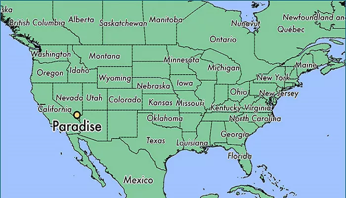
Paradise, Nevada, is an unincorporated town and census-designated place (CDP) located in Clark County, adjacent to the vibrant city of Las Vegas. Established on December 8, 1950, Paradise serves as a significant hub for both residents and tourists. Understanding its layout through detailed maps is essential for navigating its streets, attractions, and neighborhoods.
Geography and Location
- County: Clark County
- State: Nevada
- Latitude: 36.0972° N
- Longitude: 115.1467° W
- Elevation: 2,100 feet (640 meters) above sea level
Proximity to Major Landmarks
- Las Vegas Strip: Fully located within Paradise
- McCarran International Airport (LAS): 2 miles south
- Downtown Las Vegas: 4 miles northwest
- Red Rock Canyon: 17 miles west
How to Find Paradise on a Map
- Open Google Maps and search “Paradise, NV.”
- Zoom in to see the Las Vegas Strip running through it.
- Note nearby areas: Las Vegas to the north, Henderson to the east, and Spring Valley to the west.
Major Roads and Highways
Paradise is traversed by several key roadways that facilitate efficient travel within and beyond its boundaries:
- Interstate 15 (I-15): Running north-south, I-15 connects Paradise to other major cities and regions, providing access to various parts of Las Vegas and beyond.
- Interstate 215 (I-215): Encircling the southern and western portions of Paradise, I-215 offers alternative routes and access points to different neighborhoods and attractions.
- Nevada State Route 159 (NV-159): Also known as Charleston Boulevard, NV-159 serves as a primary east-west thoroughfare, linking various neighborhoods and commercial areas within Paradise.
Neighborhoods and Districts
Paradise comprises several distinct neighborhoods and districts, each offering unique characteristics:
- The Las Vegas Strip: A significant portion of this world-famous entertainment district lies within Paradise, featuring numerous hotels, casinos, restaurants, and entertainment venues.
- Paradise Valley: Located in the southern part of the town, this residential area is known for its suburban feel and proximity to local amenities.
- Spring Valley: Situated to the west, Spring Valley offers a mix of residential communities and commercial establishments, contributing to the diverse landscape of Paradise.
Points of Interest
Paradise hosts several notable attractions that draw visitors from around the world:
- Harry Reid International Airport: Serving as the primary airport for Las Vegas, this airport is located within Paradise, providing domestic and international flights.
- University of Nevada, Las Vegas (UNLV): A major public research university situated in Paradise, UNLV contributes to the educational and cultural vibrancy of the area.
- Convention Centers: Facilities such as the Las Vegas Convention Center are located within Paradise, hosting various events, trade shows, and conventions throughout the year.
Accessing Detailed Maps
For residents, visitors, and businesses seeking detailed maps of Paradise, Nevada, several resources are available:
- MapQuest: Provides interactive maps with options for directions, traffic updates, and nearby points of interest.
- World Atlas: Offers maps highlighting the location of Paradise within Nevada, along with geographical and statistical information.
- Apple Maps: Accessible via Apple devices, this mapping service provides detailed views of Paradise, including streets, landmarks, and real-time navigation.
- Simplemaps: Features customizable maps of Paradise, including overlays of zip code boundaries, major roads, parks, and bodies of water.
Conclusion
Paradise, Nevada, seamlessly blends residential communities with the dynamic energy of Las Vegas. Detailed maps of the area are invaluable tools for navigating its diverse neighborhoods, attractions, and essential services. Whether you’re planning a visit, considering relocation, or simply exploring, understanding the layout of Paradise enhances your experience and connection to this unique region.

